


Earthquakes
Deskripsi Earthquakes
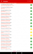
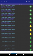
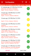
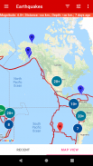
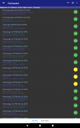
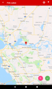
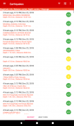
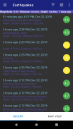
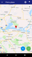
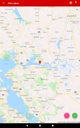
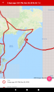
Aplikasi seluler ini dirancang untuk pengguna yang tertarik untuk tetap mendapat informasi tentang gempa bumi terbaru di seluruh dunia. Aplikasi ini menampilkan database gempa bumi terbaru, yang dapat ditampilkan dalam daftar dan peta. Tampilan daftar memungkinkan pengguna untuk melihat lokasi, besaran, dan waktu setiap gempa bumi, sedangkan tampilan peta menyediakan representasi visual dari lokasi gempa bumi.
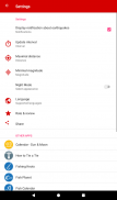
Pengguna dapat memfilter daftar gempa berdasarkan kekuatan, jarak dari lokasi saat ini, dan kedalaman. Ini memudahkan pengguna untuk menemukan gempa bumi yang relevan bagi mereka, dan untuk melihat seberapa dekat gempa bumi dengan lokasi mereka saat ini.
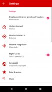
Aplikasi ini juga menyertakan fitur peringatan yang memberi tahu pengguna tentang gempa bumi baru secara waktu nyata. Fitur ini dapat diaktifkan atau dinonaktifkan, dan pengguna dapat memilih untuk menerima peringatan gempa bumi dengan kekuatan tertentu atau dalam jarak tertentu dari lokasi mereka saat ini.
Apakah Anda seorang ilmuwan, penggemar geologi, atau hanya seseorang yang ingin tetap mendapat informasi tentang gempa bumi, aplikasi ini cocok untuk Anda.
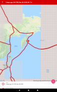
Selain tampilan daftar dan peta, aplikasi ini juga memberikan informasi rinci tentang setiap gempa, termasuk kedalaman, magnitudo, dan intensitasnya. Pengguna juga dapat mengakses riwayat gempa bumi masa lalu, yang memungkinkan mereka melacak frekuensi dan distribusi gempa bumi dari waktu ke waktu.
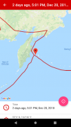
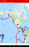
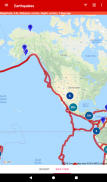
Fitur hebat lainnya dari Earthquake Alert adalah kemampuannya menampilkan gempa bumi di peta menggunakan citra satelit. Ini memberi pengguna representasi visual dari lokasi gempa bumi, dan memudahkan untuk melihat kedekatan gempa bumi dengan daerah berpenduduk.
Peta tersebut juga menunjukkan batas lempeng tektonik tempat terjadinya gempa bumi, memungkinkan untuk menilai negara dan wilayah yang berbahaya dan aman di planet ini.
Data gempa diambil dari program resmi "USGS", "Program seismik Eropa" - "EMSC" dan "Layanan GeoNet Selandia Baru".
Earthquakes - Versi 3.3.39
(02-04-2025)Earthquakes - Informasi APK
Versi APK: 3.3.39Paket: com.kb.apps.earthquakesVersi Terakhir dari Earthquakes
Versi lain


 3.64
3.64


Aplikasi pada kategori yang sama

Anda juga mungkin suka...
Aplikasi pada kategori yang sama


